
Land & building Surveying works
Tamizh Constructions
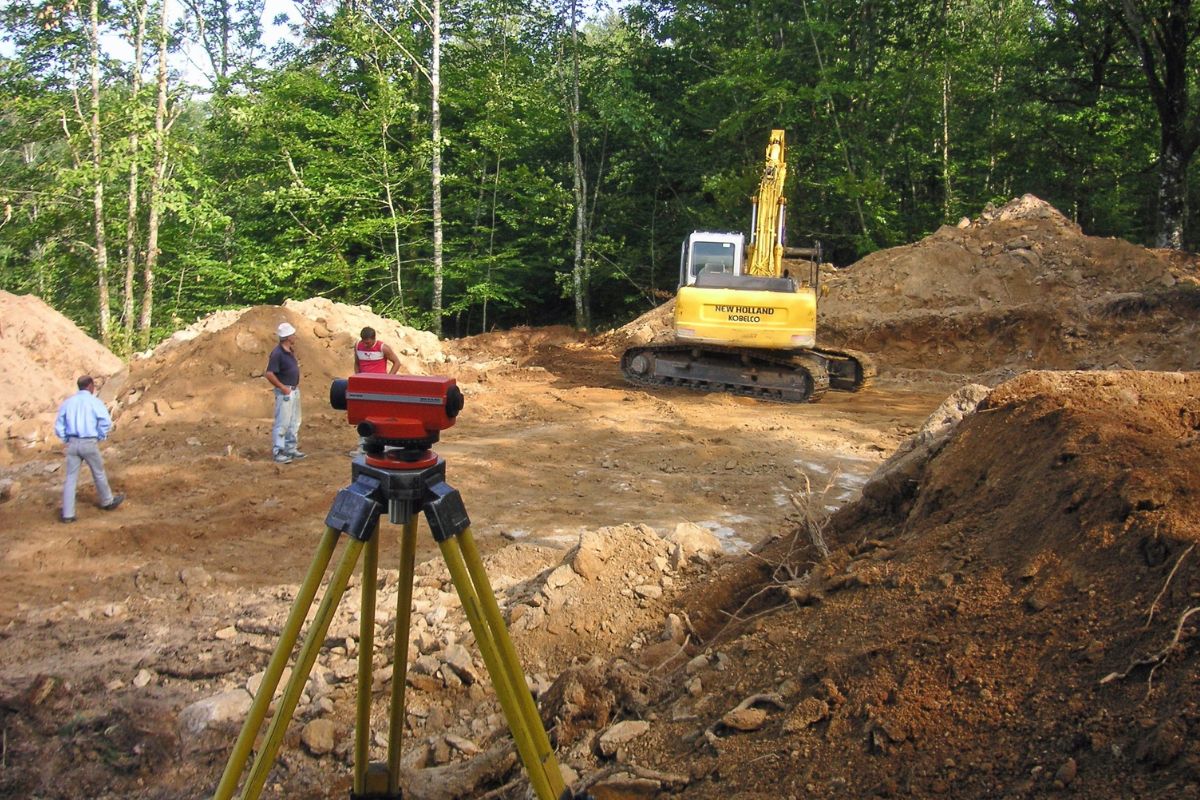
Land & Building Surveying Works
Land & Building Surveying Works provide accurate measurements, boundary confirmations, structural evaluations, and detailed mapping essential for safe construction and legal compliance. Our expert team uses advanced surveying tools to assess land levels, building alignment, plot dimensions, elevation data, and property boundaries with precision. These surveys help prevent disputes, support project planning, and ensure regulatory approval. With professional expertise, reliable reporting, and clear documentation, we deliver trusted surveying solutions for residential, commercial, and industrial property requirements.
- Accurate Boundary Mapping
- Structural Assessment
- Advanced Survey Equipment
- Reliable Elevation Data
- Professional Survey Reports
- Legal Compliance Assurance
Years Experience
0
+
Best Services
0
+
Expert Employees
0
+
Happy Customers
0
K+
Tamizh Constructions
Why You Need Surveying Works
Confirm Property Boundaries
Surveys prevent disputes by clearly identifying exact land limits legally and accurately.
Ensure Construction Accuracy
Proper measurements guide builders, ensuring safe, correct positioning of structures.
Avoid Legal Issues
Accurate surveying prevents encroachments, helping meet all required regulations.
Support Project Planning
Survey data ensures proper design, layout, and development decisions.
Get Started
Transform Your Ideas into Reality with Tamizh Constructions
Contact us today to explore budget-friendly construction services without compromising on quality, safety, or timely delivery. Let’s build your dream project efficiently and affordably!

Tamizh Constructions
Frequently Asked Question
Get answers to frequently asked questions about our services, processes, timelines, pricing, quality, and support.
Surveying involves measuring land boundaries, building alignment, plot size, and elevation to prepare accurate reports for construction, planning, and legal documentation.
It ensures precise foundation placement, correct layout, and safe building positioning, preventing costly structural or legal issues later.
Surveying is required during property purchase, construction, renovation, boundary disputes, or whenever accurate land measurement is needed.
Yes, we provide detailed digital reports with measurements, maps, elevations, and boundary details for easy reference and submission.
We use advanced tools like total stations, GPS systems, laser devices, and mapping software for highly accurate results.